Wednesday, January 30, 2013

Latest statewide surface observations show temperatures still in the mid & upper 50s! Cold front is still several hours away, near east/central Indiana. Snow is being reported west of that blue line which demarcs the actual cold front. And of course it's also quite cold and windy too!

For tonight, continued breezy with temperatures falling into the upper 20s/low 30s. Precip will changeover to snow around 1 AM and linger into at least early afternoon in the high mountains of West Virginia. Less than an inch of snow is expected to fall in the lowlands and much of that will melt away! In the mountains, we could see 2 or 3" accumulation by Thursday morning. Continue to monitor possible rising water levels in your area overnight/Thursday. Also watch for slick spots as you head out the door on Thursday. Any standing water on roadways/overpasses will freeze overnight. We'll keep the cold air and occasional snow for Friday and Saturday. Temperatures Friday night will get down to about 10°! We'll have trouble breaking above freezing this weekend! Here's the snowfall forecast through early Sunday morning. 2-5" in the lowlands with another couple of inches in the higher elevations...not written in stone of course, but that's something for you to go on!

Regional radar is still busy with some high reflectivity values moving into north/central WV at half past four o'clock. Other news: some strong wind gusts were reported, mainly across central and southern WV today. Winds caused some minor damage (mainly downed trees). Flood watches and warnings remain in effect through early Thursday morning. High wind watches and warnings are also still in effect until 1 AM Thursday. Overall, was not impressed with the strength & duration of storms that crossed our area. But this should not come as a surprise being late January. I think if that squall line had arrived a few hours later, storms may have been stronger. What's more impressive is the near 40° temperature drop that we will see from this afternoon to tomorrow morning! That's right, lows will dip down into the low 30s by morning. Expect to see a dusting of snow on the ground in the lowlands and 2-3 " in the mountains by Thursday morning. More in a bit...

Squall line just into our western counties & into Huntington area at 10:00! Severe storm & tornado watches posted for that area. Could see an upgrade to warning later today...also watch for gusty winds AND high wster around flood prone areas!

Tuesday, January 29, 2013

Some productive storms today! Abundant lighting, heavy downpours, gusts to 65-70 MPH, 1.5" hail and minor flooding have been reported! A radar estimated inch and a half fell near Chicago! At least one tornado was reported today by a trained weather spotter in Crawford Co, AR. And there's already a thin band of snow on the backside of the system out west! For us, that line of rain showers & storms will be on our grid by mid-morning. Like we've said, heavy downpours, winds gusting to 30 or even 40 MPH are possible throughout the day & into the evening on Wednesday. Little bit of minor flash flooding is also possible into Wednesday evening. As colder temps mix in behind the front, we'll get in on some snow with minor accumulations by Thursday morning. We'll be back in the 20s and low 30s...teens for lows by the weekend!

FLASH FLOOD WATCH FOR BRAXTON-LEWIS-HARRISON-TAYLOR-NICHOLAS-WEBSTER-UPSHUR-BARBOUR-POCAHONTAS-RANDOLPH Wednesday afternoon through Wednesday evening

Hampshire County friends, keep an eye on the water levels over the next 72 hours. NWS hydrologists have issued a flood watch for your area of the South Branch of the Potomac! Highest water levels are projected by Thursday afternoon. This could trigger some minor flooding in your area. There is also a high wind advisory for Hampered, Mineral,  Hardy, Grant, Pendleton counties from Wednesday afternoon until Wednesday night! Gusts could reach 50 MPH during this time!

Nice day today, right?! Well we're still expecting that squall line to blow through tomorrow with some tstorms possibly producing some heavy downpours. Main weather threat will be damaging straight line winds with gusys to 60 MPH (not tornadoes) but a tornado or two could spin up if conditions are just right, especially further south! Keep an eye on the weather tomorrow! Here's a map showing probability of severe winds Wednesday. Then behind the front we'll see much colder temperatures and a couple inches of snow Thursday. More on that later!

Tstorms producing damaging winds and possible tornadoes move through Dixie today! Tell friends and family that are in this area to stay weather aware today! Closer to home,  we have a pretty nice day on tap with highs in the 60s! Isolated showers possible today. Windy & warm overnight and Wednesday. Cold front brings more winds with colder temps and some snow for Thursday!

Monday, January 28, 2013

A few winks of sunshine for lunchtime on this Monday. But another band of showers is moving into WV headed ENE for early afternoon. Some showers upstream have been moderate to heavy in parts of OH & KY. We'll keep scattered rain showers into the overnight hours with near steady temperatures in the low/mid 40s.  Watch for patchy fog on the AM!

Bufkit's temperature trend this week for Morgantown. Yep, the trap door opens up Wednesday night. Temperatures will continue to plunge in the second half of the week! Some severe weather possible this week as well. Main threat for West Virginia will be damaging straight line winds. Elsewhere, tornadoes not out of the question across the southern plains and southeastern US.

Sunday, January 27, 2013

Some shower activity headed east into our area. Temps in some spots are already below freezing. Check that thermometer tomorrow! The northern counties and eastern panhandle will be coldest.

Freezing rain advisory expanded into several central WV counties for Monday morning. Elsewhere, sleet and snow could mix in by sunrise. Lows will fall into the low 30s with lots of places at o  below freezing. Not a lot of accumulation expected but enough to make it slick. Timing looks to be right as we head out the door Monday morning. Not so much a problem for southwestern WV;just rain. Careful out there on untreated surfaces tomorrow!

Severe weather threat areas for Tuesday (top) and Wednesday (bottom) next week!

Moisture returns to the area tonight with rain mixing with sleet and freezing rain and snow in the mountains. With the existing snow pack and overnight lows falling into the low 30s, mixed precip & some slick spots will likely effect our morning commute on Monday. NWS has issued winter weather advisories in the north and east and a freezing rain advisory for Pocahontas, Greenbrier counties/southwestern VA. Advisories are effective after midnight tonight until noon on Monday. Garrett County, MD is also under a winter storm warning for the same timeframe. Forecast will feature mild daytime temps and occasional rain showers into midweek. Strong cold front will backhand the eastern US Wednesday night/Thursday.

Saturday, January 26, 2013

Clear & very cold tonight with temperatures in the low teens. Weather advisories expired but be careful on untreated streets. Still some icy spots out there! Chilly start Sunday with a sun/cloud mix in the morning. Daytime temperatures will actually break above freezing with highs in the upper 30s in the lower elevations. Moisture returns late Sunday into Monday with scattered rain showers. Watch for freezing rain by Monday morning with lows near freezing. Breezy & warmer with periods of rain for Monday and Tuesday. Winds out of the south will put temperatures nearly 20° above normal with highs into the 40s & 50s. Continued breezy Wednesday as a strong cold front crosses the eastern US by Wednesday night/Thursday next week. That'll bring temps in the teens and 20s with snow to round out the week next week. Temperatures on this 850mb map (5000ft) are a good gauge of temperatures at the surface. There's Tuesday on the left, Wednesday night in the middle and Thursday night on the right...Back to reality!

Thursday, January 24, 2013

Chilly Friday with afternoon snow showers & highs in the mid 20s. Near steady temps Friday night with lows in the upper teens/low 20s. Snow showers ending in the lowlands Friday night. Leftover snow showers likely across the higher terrain into Saturday. 2-5"  for most of the lowlands of WV. 8-10" higher up. Clear & cold Saturday night with single digit lows again. Temperatures rebound Sunday into next week. Take a look at Tuesday! We're back into the GREEN! Lookin' forward to 50s!

As much as 13 inches of snow lies on the ground in Randolph County today! Here are some other snow reports that came to the NWS from the Mountain State!
Belington 6"
Philippi 3"
Flatwoods 4"
West Union 1"
Mount Nebo 3.5"
Glenville 4"
Richwood 5"
Snowshoe 8"
Grafton 1"
Middlebourne 1"
Buckhannon 5"

Winter weather advisory (purple) is effective from 8 AM Friday until 7 PM Friday. Winter storm warning (pinkish) for Garrett, Preston & Tucker counties from noon Friday until 7 PM Saturday. Impacts include snow covered roads and reduced visibility. Stay safe out there people!

Some new stuff for ya...mostly cloudy & cold tonight with lows near 9°. Winter weather advisory is in effect for a large portion of WV. Winter storm warning has been issued for the mountain counties. More on that shortly...A brief period of freezing rain is possible, mainly in the south early Friday morning. So watch for slick spots as you head out the door Friday morning! The rest of the day will feature snow showers with highs in the mid 20s. Here's a look at what one of the forecast models is saying for snowfall totals by lunchtime Saturday. 2-5" in the lowlands and 8-10" along the higher terrain! 

Wednesday, January 23, 2013

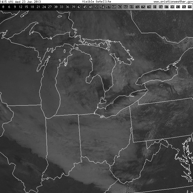
Increasing cloud coverage for the rest of today with highs near 20°. Snow showers on tap this evening and overnight with 1-2 inches across north central WV. Only a dusting of snow is expected in the southern two-thirds of the state by Thursday morning. Lows dip into the low teens, but at least we're talkin' double digits! Another round of snow arrives Friday. Models spitting out 2-3 inches across most of WV.

Tuesday, January 22, 2013

Wind chill advisories remain in effect until noon Wednesday. Wind chill indices will bottom out at 10-15 below & as cold at -25° in the mountains.

Another deadly cold night is in store tonight. Lows falling to near zero along with west winds at 10-15 MPH (gusts to 30 MPH) will make it feel as cold as -25° F tonight! Stay indoors & throw another log on the fire. Wednesday will be partly to mostly cloudy with highs in the upper teens/low 20s. More snow will move into the area Wednesday night. An inch or two accumulation is possible by Thursday morn. ANOTHER strong low pressure system bring accumulating snow to West Virginia Friday into the weekend. This is ONE forecast model's interpretation of total snowfall amounts by Friday night. There's still plenty of time to fine tune this thing. for now, we'll call it 3-6" in the lowlands and 5-8" in the mountains through Friday. Check back later & keep cozy!

Monday, January 21, 2013

Here comes that arctic air! Take a peek at the 24 hour surface temperature change. We've pretty much seen our high temperature for today. Conditions for the rest of today will turn even colder and breezy with lows falling into single digits. Calculating the wind speeds, it will feel as cold as -25° F tonight along our highest terrain! So the 24 hour temp change numbers will continue to fall over the next 24-36 hours. Oh yeah, and we'll tap into a little bit of snow too! 1-3" of snow are possible, mainly across north/central WV now through Tuesday evening.
Most dog breeds cannot stand extreme cold for very long. Here's a few can thrive in it! Unless you have one of these...#bringyourdoginside http://unofficialnetworks.com/top-5-mountain-dogs-100070/

WIND CHILL ADVISORY

A wind chill advisory (light blue) is in effect from 10 PM tonight through 11 AM Tuesday. Temperatures ranging from single digits to the middle teens with sustained winds at 15-20 MPH (gusts to 35 MPH) will combine to bring the apparent temperature down into the 0°/-10° range tonight and Tuesday. Wind chill values could fall as low as -25° F along our ridge tops! These conditions will quickly lead to frostbite and hypothermia if necessary precautions are not taken. If you venture out, please be sure to cover up! Do not send your kids out without heavy coats. If at all possible, limit your outdoor activities tonight & tomorrow. If your pet is not usually allowed indoors, please make an exception tonight, Tuesday & Tuesday night!! Only the most beastly of animals are capable of weathering this kind of cold! Temperatures will rebound by a few degrees Wednesday. Occasional snow showers are expected Monday afternoon, lasting throughout the week with light accumulations for now. But forecast models are leaning towards some heavy snow accumulations with the next frontal system Friday. More on that over the coming days! Stay warm!!

Sunday, January 20, 2013

CAUTION BURNING

Low relative humidity values and winds gusting to 30mph will combine to create an enhanced fire threat this evening. Low 20s tonight. Temps fall into single  digits by Monday night. Gusty winds and snow showers Monday and Tuesday. Snowfall will amount to an inch or two, mainly north. More importantly, wind chill numbers will be near zero for a while Monday night/Tuesday night! Temperatures rebound Wednesday bu  still plenty cold. More snow in the forecast through the week. More on that next time!

Saturday, January 19, 2013

One heck of a nice day is on tap today with sunny skies and highs in the 40s & 50s! Enjoy it. The first of two cold fronts arriving tonight will bring breezy conditions, more clouds & a dusting of snow in the northern counties. The second front will bring more wind & significantly colder temperatures Monday & Tuesday. With the breeze AND the arctic air, wind chill values will fall to near 0° next week! Next week's forecast also includes accumulating snow! More later!

Monday, January 14, 2013

Moisture associated with that stationary front lingering over our eastern mountains will lift north overnight/Tuesday. This will keep the chance for a mixed bag of wintry precip tonight into Tuesday morning. Northern edge of precip could reach as far north as Rt 50 in the western counties overnight. While the entire eastern panhandle of WV will stay saturated throughout the morning on Tuesday. We'll break the precip down like this: light drizzle this evening will change to sleet in north/central WV with isolated pockets of freezing rain into Tuesday. Could also see a dusting of very wet snow across our northern mountain counties early Tuesday. Lows will fall into the upper 20s to the north tonight. While further south, lows will stay in the mid/upper 30s. So even though accumulations will be very light, the mixed precip could result in some icy roads Tuesday morning. Be careful as you head out the door in the AM! We'll catch a few breaks in the clouds during the day on Tuesday, especially across our northern counties. Meanwhile, mixed precip will change BACK to rain in the south and east. Highs reach the upper 30s/low 40s. Light rain showers will creep back north again Tuesday evening. Then more mixed precip will be briefly possible Tuesday night as temps drop below freezing across our northern counties. Things dry out quickly Wednesday morning from north to south. Forecast will stay dry & mainly sunny with highs near 40° to round out the rest of this week. More wet weather arrives late Sunday. 

Well the weekend was good to us-can't argue with that! Our weather this week won't take it so easy on us. Temperatures will trend to more seasonal numbers with highs managing mid 40s (still a few degrees warmer than usual) & lows dipping below freezing each night. This cold front responsible for bringing us back to reality will become stationary today, keeping wintry precip in the eastern mountains of West Virginia tonight & Tuesday night. High pressure will then dry things out with sunshine and seasonal temps into the weekend. Next cold front brushes the area next Sunday. Tonight's forecast could include some slickery roads Tuesday morn. More on tonight's forecast later today! 

Tuesday, January 8, 2013

After a decidedly chilly start, we'll see highs this afternoon reaching the mid/upper 40s to 50°. Plenty of sunshine is in store. So today will turn out like a Spring Break teaser! Tonight will be clear with lows in the low 30s. More of the same is on tap for Wednesday with highs in the upper 40s/low 50s. Expect increasing cloud cover by Wednesday evening. Periods of rain Thursday & Friday with highs near 60°! 

Monday, January 7, 2013

Low level moisture clears out of the Appalachians today courtesy of high pressure building overhead. Forecast will stay dry through Wednesday. Temperatures stay in the 30s this afternoon under clearing skies. Tonight will be mainly clear with lows falling into the low/mid 20s. Warmer and sunny Tuesday with highs hitting 50 across most of the low-lying areas of the Mountain State. The northern mountain counties will be slower to let go of the cold air and highs will only reach the mid/upper 40s on Tuesday. Daytime temperatures will continue to hit the 50s this week. Some places will even see highs in the low 60s by Friday! But moisture returns to our forecast area in the form of rain showers Wednesday night. Periods of rain are expected Thursday and Friday. 

Image, courtesy of Unysis Weather shows this morning's 500 mb analysis. We're directly under the light blue 'H' this morning. That means mainly clear skies & dry weather for the first half of this week. Then that low pressure system rotating over southern CA/AZ will trek across the nation's mid-section, arriving with rain and above normal temperatures by Thursday/Friday. Pants optional! Have a great week! 

Friday, January 4, 2013

It was a quiet day on satellite and radar today with just a few passing clouds. Temperatures remain on the cool side with Morgantown checking in at 32° at the top of the hour. Lows dip into the upper teens/low 20s tonight under partly cloudy skies. Breezy conditions are possible tonight, especially along our ridge tops. So it's another cold one tonight! Daytime temperatures will try to reach a few degrees warmer this weekend with highs into the mid/upper 30s. Further south, folks should have no trouble seeing highs into the 40s on Saturday and Sunday. A couple of weather disturbances will cross our area to bring mainly light snow Saturday night followed by mixed precip on Sunday. Very little snow accumulation is expected over the weekend. But the mixed precip will likely result in a few slick spots, especially overnight & early Sunday morning. Lingering mountain snow flurries are likely into early Monday with highs into the mid 30s. Then we'll enjoy a nice bump in temperatures through the rest of next week. Highs will reach into the mid/upper 40s and possibly even low 50s! 

Tuesday, January 1, 2013

We've got a couple of cold ones on tap- but not the kind of cold ones you're thinkin' of! Lows fall into the upper teens across northern WV tonight. Then dip into the low/mid teens Wednesday night! Daytime highs struggle to break the freezing mark. But for the rest of tonight, conditions gradually improving thanks to a nose of high pressure building to our west. But low level moisture just to our south could still bring a sprinkle of freezing rain across our southern counties before midnight. Otherwise we're dry for midweek. Next disturbance clips our northern counties Thursday night/Friday.