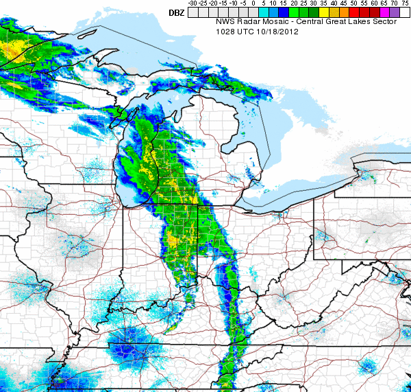
Another warm day is on tap with highs in the upper 60s. But here comes the cold front! We've seen some heavy rain & strong winds as this system pushes eastward across the Ohio Valley. Some weakening is expected this morning as it encounters the mountains of West Virginia. Then by lunchtime we can expect some restrengthening into this afternoon. Gusts will approach 20-30 mph at times, especially across our Potomac Highlands & the Eastern Panhandle. The Storm Prediction Center has included all points east of I-79 in their slight risk of severe weather for this afternoon & evening. Leftover rain showers will slowly wind down early Friday. Then a chilly wet weekend is in store in our northern counties.